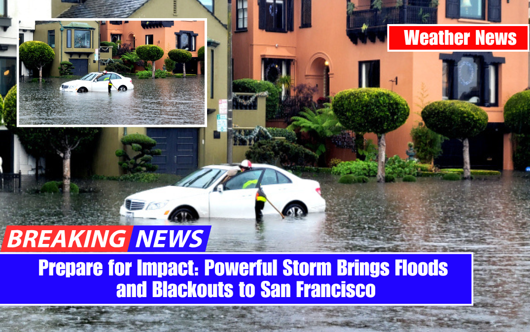
San Francisco is about to be hit by a powerful storm system, and it will not be pretty. Meteorologists are warning of intense downpours, winds gusting up to 55 mph, and even flooding in low-lying areas. If you live in the Bay Area, now is the time to prepare because this storm may cause significant disruptions to daily life.
What’s Happening?

A powerful atmospheric river—a weather phenomenon that transports massive amounts of moisture from the Pacific Ocean—is heading straight for Northern California.
These systems are notorious for dumping large amounts of rain in a short period of time, causing flooding and landslides, particularly in areas with already saturated soil.
Starting Tuesday night, the storm will quickly intensify, bringing heavy rain, strong winds, and even snow in the mountains. The worst weather is expected on Wednesday and Thursday, when a combination of rain and wind could make roads dangerous and cause power outages in some areas.
Day-by-Day Breakdown

Tuesday, March 11:
- Expect increasing cloud cover throughout the day. It will feel humid and breezy.
- Rain will start in the evening, but nothing too heavy just yet.
- High: 61°F (16°C) | Low: 50°F (10°C)
Wednesday, March 12 – The Worst of the Storm Hits
- Heavy rain all day with totals reaching up to 2 inches in San Francisco, with even more in the surrounding mountains.
- Winds between 40-55 mph will make walking outside difficult and could bring down tree branches and power lines.
- Flash flooding is possible in low-lying areas, so avoid driving through standing water—it’s often deeper than it looks.
- High: 58°F (14°C) | Low: 49°F (9°C)
Thursday, March 13 – Storm Continues
- Showers will continue through the day, and some thunderstorms are possible, bringing small hail and strong gusts.
- Snow levels may drop to 2,500-3,000 feet, meaning areas in the Sierra could see dangerous winter conditions.
- Expect flooding risks to persist as the ground will already be saturated from Wednesday’s heavy rain.
- High: 56°F (13°C) | Low: 47°F (8°C)
What This Means for You
- Flooding Risks – Low-lying areas, creeks, and roadways could quickly fill with water. If you live near a flood-prone area, consider sandbags and move valuables off the floor.
- Strong Winds – Winds up to 55 mph are strong enough to knock down trees and power lines. Have an emergency plan in case of power outages. Charge your phones and have flashlights ready.
- Hazardous Travel – Roads will be slick, and visibility will be poor. If you must drive, slow down and leave extra distance between cars. Avoid mountain roads where snow could create dangerous conditions.
- Power Outages Likely – Strong winds and rain could bring down power lines, leading to blackouts in parts of the Bay Area. If your home loses power, use flashlights instead of candles to avoid fire hazards.
How to Stay Safe and Prepare
- Stay indoors as much as possible during the heaviest rain and winds.
- Keep phones, flashlights, and backup batteries charged in case of a power outage.
- Avoid travel unless necessary, and if you must drive, be extra cautious.
- Stock up on essentials like bottled water, food, and emergency supplies.
- Secure any loose outdoor items—patio furniture, trash bins, and decorations could be blown away.

This storm isn’t just another rainy day in San Francisco; it’s expected to be one of the season’s strongest. Prepare for flooding, strong winds, and power outages as the system passes through the Bay Area. Stay tuned for updates from the National Weather Service and local authorities, and most importantly, stay safe!