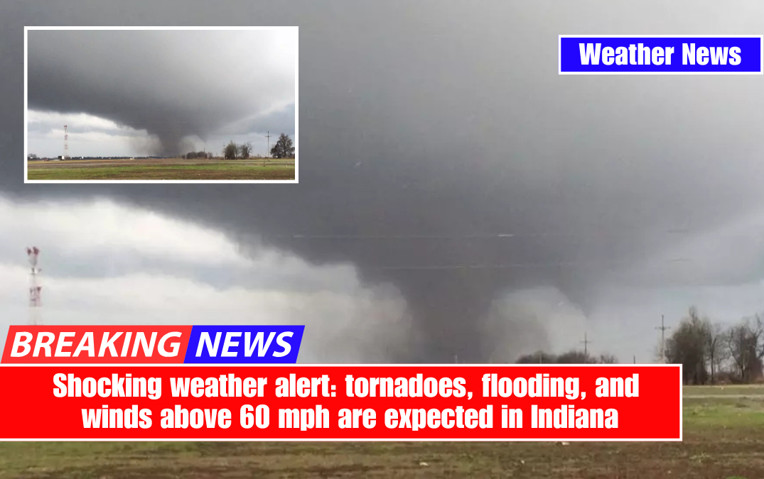
If you have weekend plans in Indiana, consider rethinking them. A powerful storm system is expected to move through the state on Friday and Saturday, bringing torrential rain, damaging winds, and the possibility of severe thunderstorms.
Weather experts are warning of localised flooding, power outages, and even the possibility of tornadoes, so stay alert and prepared this weekend.

What to Expect Across Indiana
Friday, March 14: Calm before the storm. Unseasonably warm temperatures are expected, with highs near 78°F (25°C) in Indianapolis, 72°F (22°C) in Fort Wayne, and 78°F (26°C) in Evansville. While most of the day will be dry and breezy, meteorologists warn that the atmosphere is preparing for severe storms by the evening.
On Saturday, March 15, things take a turn for the worse. A strong storm front will move across Indiana, bringing heavy rain, high winds, and severe thunderstorms.

According to forecasts, rainfall totals could exceed 2 inches in some areas, causing flash flooding in low-lying areas with poor drainage. Wind gusts of 60 mph or higher may cause tree damage and power outages. The main concern? Some of these storms may become severe, resulting in large hail and isolated tornadoes.
Why This Storm Is a Big Deal
Unlike a typical rainstorm, this system is fuelled by a clash of warm and cold air masses, resulting in ideal conditions for explosive storm development.

The strong jet stream overhead, combined with moisture-rich air from the Gulf of Mexico, will intensify thunderstorms, increasing their ability to produce dangerous lightning, damaging winds, and fast-moving tornadoes.
Flash flooding is also a serious issue. With heavy rains forecast, roads may become impassable, and small creeks and rivers may quickly overflow their banks.
Emergency responders are urging residents to stay off the roads during the storm’s peak and to avoid flooded areas. Remember that just six inches of moving water can knock someone down, while a foot of water can sweep away a vehicle.
How to Stay Safe During the Storm
- Stay Updated: Keep track of weather alerts through NOAA Weather Radio, local news, or a reliable weather app.
- Secure Outdoor Items: High winds could turn patio furniture, grills, and decorations into dangerous flying debris.
- Prepare for Power Outages: Charge your devices, stock up on flashlights, and have extra batteries ready in case the lights go out.
- Know Your Safe Shelter Spot: If tornadoes are possible, identify a sturdy indoor location away from windows, such as a basement or interior room.
- Avoid Flooded Roads: Never drive through floodwaters—“Turn Around, Don’t Drown.”
Residents of Indiana should take this storm threat seriously. This is not your typical weather event, with heavy rain, damaging winds, and severe storms on the way. Be alert, make emergency preparations, and have a plan in place before the storm hits. This weekend could be dangerous; don’t take any chances with Mother Nature.